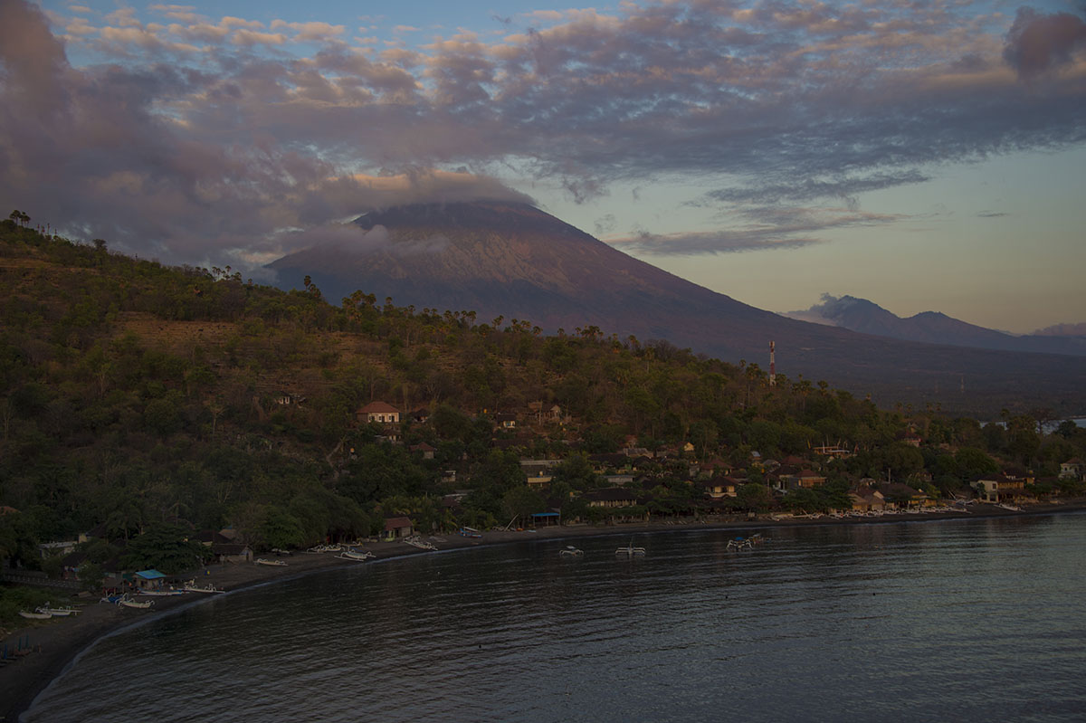
Mount Agung has been threatening to erupt for the first time in more than 50 years. The volcano last erupted in 1963 which left nearly 1,600 people dead. Indonesian officials raised the alert status to the highest level on late Friday, September 22. Over 144,000 people have fled the volcano and its vicinity since it started rumbling, but officials urged evacuees who are from outside of the immediate danger zone to return home.
Indonesia's national disaster mitigation agency spokesman, Sutopo Purwo Nugroho also reassured locals and tourists that they will be safe as long as they stay out of the danger zone, which is a nine-kilometre radius from the 3,031-metre Mount Agung.
According to volcanologists, Mount Agung hurled ash as high as 20 kilometres when it erupted in 1963 and remained active for about a year. Lava from the volcano travelled as far as 7.5 kilometres while volcanic ash reached Jakarta (the capital city of Indonesia), which is about 1,000 kilometres away.
Indonesia sits on the Pacific "Ring of Fire" where tectonic plates collide, causing frequent seismic and volcanic activity.
With over 100 volcanoes within the archipelago, Indonesia is geologically the most dangerous terrain globally.
Mount Agung
On September 22, 2017 Indonesian authorities raised the alert status of Mount Agung from level three to level four (the highest level) at 8.30pm local time. Indonesia's Ministry of Energy and Mineral Resources also reported that a total of 11,663 earthquakes had been recorded in Mount Agung – between September 19 and October 3 (6am local time) – while 707 of them were tectonic earthquakes.
In 1963, lava devastated nearby villages and left almost 1,600 dead. In response to the latest eruption threat, Indonesian authorities have urged locals and tourists to evacuate from the danger zone, which is a nine-kilometre radius from the volcano.
Nur Iskandar Taib, senior lecturer at the Department of Geology, University of Malaya told The ASEAN Post, "the eruption might cause several sorts of impact. It produces pyroclastics like ash and debris that are going to cover the ground. Crops will be affected and gases that are released are poisonous."
"The pyroclastics also tend to be unstable. When it rains, there tend to be landslides," he added.
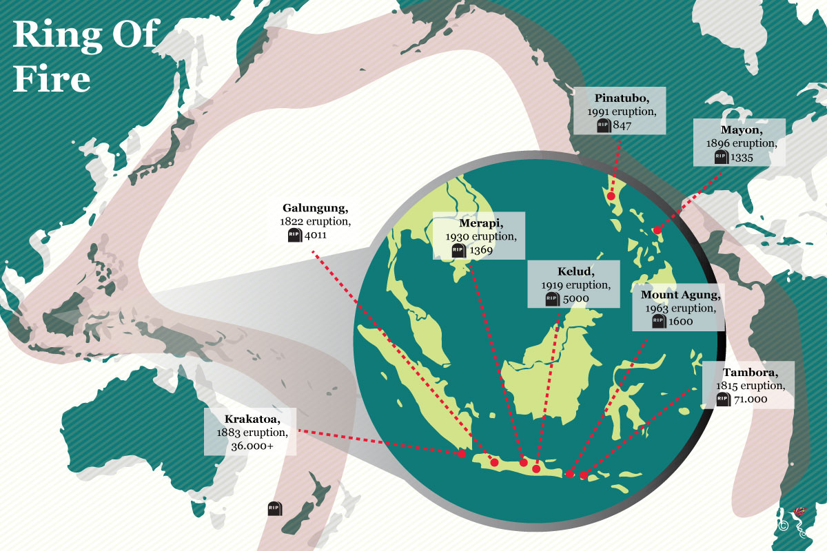
The Pacific "Ring of Fire".
Ring of Fire
Mount Agung isn't the only volcano that is threatening to erupt at this moment. The Manaro Voui volcano in Vanuatu has also been rumbling in recent weeks. All 11,000 people who live on Ambae, in the north of the Pacific archipelago, were ordered to leave after the Manaro Voui volcano rained rock and ash on villages last week. However, the volcano stablised earlier today. According to AFP (Agence France-Presse) Vanuatu's official Geohazards Observatory said the threat had eased, although it maintained the volcano's status as level four, its second-highest rating. The Manaro Voui also sits on the Pacific "Ring of Fire."
Other major volcanic eruptions in the Pacific "Ring of Fire" include the 1883 eruption of Krakatau in Indonesia and the 1991 eruption of Mount Pinatubo in the Philippines.
(Shenntyara Mirtha contributed to this article.)